")
Going around in a big city can be daunting, especially if it’s a collective cities like Metro Manila. However, sometimes there’s no getting away trying to find and get to places with work, leisure, or even when visiting a family member. Here are navigational apps you must have on your mobile phones to help you navigate Metro Manila like a boss.
Google Maps

Google Maps is a web mapping service developed by the digital giant, Google. Almost everyone knows Google Maps exist but you can fully appreciate its features when you use it to navigate big cities. It offers satellite imagery, aerial photography, street maps, 360° panoramic views of streets. Not only does it gives you different set of maps but it can also show real-time traffic conditions, and route planning if you plan to travel by foot, car, bicycle and air, or public transportation.
Waze

Waze is one of the popular GPS navigation software. It works on smartphones and tablet computers that have GPS support. It is also used by popular ride-hailing apps to help their drivers navigate unfamiliar roads but is also a preferred app for those with private vehicles. It provides turn-by-turn navigation information and user-submitted travel times and route details.
Sakay.ph
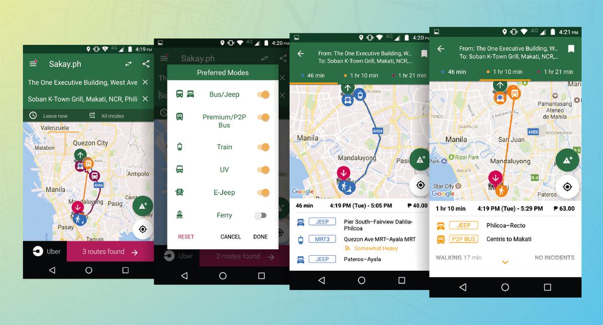
Sakay.ph the commuting lifesaver navigational app in the Philippines. It provides the most accurate and efficient directions around Metro Manila when you plan to take public utility vehicles to get to your destination. It shows you what type of public utility transport to take, expected time of arrival, how much the fare is, and offers different routes for you take choose from.
Having to get to one city to another in Metro Manila can be stressful. But with the help of navigational apps like Google Maps, Waze, and Sakay.ph, it is easier to plan your commute.
